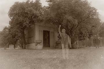
What are Gothic stories?
October 7, 2026
Now through October 31, we're waiving application fees for all freshman and transfer applicants!
*Common app code: Central27
Climate expert shares how warming Pacific could shape your winter
Daria Kluver is a faculty member in Central Michigan University’s Department of Earth and Atmospheric Sciences and an expert in the impact of large-scale atmospheric phenomenon on regional climates. She has written or contributed to multiple research papers about the impact of global climate phenomenon on local weather patterns.
Key takeaways
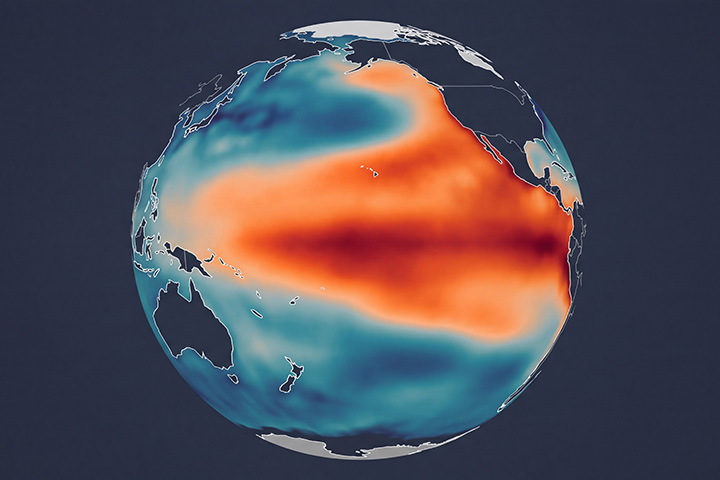
“Super El Niño” is not a technical term and is probably referring to the highest category of events in the Relative Oceanic Niño Index. When sea surface temperatures in the middle of the equatorial Pacific are 0.5°C warmer than average we have what is called an El Niño event. An even would be classified as moderate if sea surface temperatures are between 1 to1.5° C warmer than average, and Very Strong if temperatures are 2°C or more above normal.
The area of the equatorial Pacific Ocean that is monitored for temperatures indicating an El Niño event is quite large. It is called the Niño 3.4 region, and is approximately 2.4 million square miles, or about the size of 42 Michigans. Such a large area of the ocean surface with unusually warm temperatures impacts the location of low pressure and convection in the tropics, which can impact the jet streams and our weather in the Great Lakes region.
El Niño events impact the Great Lakes region by altering the location of the jet stream. The jet stream is a river of fast-moving air at the top of the troposphere (about 30,000 ft up, roughly when airline jets fly), that separates the cold Canadian/Arctic air from the warmer mid-latitudes air.
During an El Niño event the warm water and convection move east across the Pacific Ocean, which pushes the sub-tropical jet stream north into the southern tier of the United States, often bringing heavy precipitation and flooding. This in turn shifts the polar jet stream farther north, which tends to keep the cold arctic air in Canada, leaving the Great Lakes warmer than normal. This effect is most pronounced in the winter months.
El Niño impacts are the most apparent during the winter months, and a “super” El Niño will have the same fingerprint. The last time there was a Very Strong El Niño was in the winter of 2015-16, where the Niño 3.4 region was as warm as 2.4°C above average. The winter of 1997-98 and 1982-83 were the other two Very Strong El Niño events in recent history. Strong El Niño events tend to produce warmer than average winter temperatures by as much as 5°F and 25-50% less snowfall. However, El Niño winters don’t always result in less precipitation. Every El Niño event can be a little different because of other things that change around global weather (e.g. amount of arctic sea ice, conditions in the upper atmosphere, etc). Sometimes the warmer temperature will mean our precipitation comes in the form of rain or ice rather than snow.
In the most recent El Niño Advisory issued by NOAA Climate Prediction Center their seasonal forecast models indicate a 63% chance of a Very Strong El Niño during November – January.
Around the world El Niño events cause more flooding in the southern United States, drought in the western Pacific, excess rain and flooding in the eastern Pacific, fewer Atlantic hurricanes, and more Pacific hurricanes. Severe weather in the Great Lakes region is not directly impacted by El Niño events, especially since its impact is strongest in the winter months.
El Niño patterns usually develop during the summer and become the strongest during winter months. Sea surface temperatures in the equatorial pacific usually return to near-normal by the next summer. Rarely, El Niño events can last more than one year, but do not maintain the large temperature anomalies.
About Daria Kluver
 Daria Kluver is a faculty member in Central Michigan University’s Department of Earth and Atmospheric Sciences. She received her doctorate in climatology from the University of Delaware. Her interests include seasonal prediction, the influence of large-scale atmospheric phenomena on regional climates and spatial data analysis.